The Richland Balsam area boasts the highest point on the Blue Ridge Parkway.
The air can be 20°F cooler than the surrounding valleys. The fog and low clouds can shroud the parkway through the entire morning. The wind can chill you to the bone if you’re not prepared. But when the clouds lift, the views from the overlooks are breathtaking.
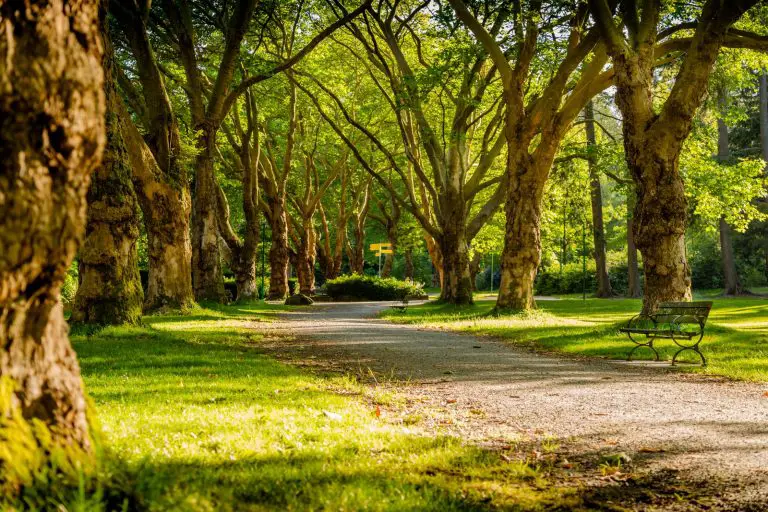
When I came through this section of the parkway in late April, I was expecting the cooler temperatures, but not the fog. I arrived at Richland Balsam overlook, the highest point on the parkway, at about 10:15 am.
The clouds were blowing up from the valleys. The clouds were drifting down from the mountaintop. It just didn’t seem like it would clear up any time soon.
Blue Ridge Parkway Lodging
I went on to Waterrock Knob and returned a couple of hours later to much better views of the Great Balsam Mountains. Here at milepost 431, with an elevation of 6053 feet (1845 meters) the scenery is fantastic. It’s the kind of view that makes you want to stay in these mountains. Lodging can be found in nearby Waynesville, NC (Highway 23/74).
Blue Ridge Parkway cabins would be a good choice. Nothing says mountain getaway like a log cabin. Many are equipped with kitchens. Cabins and other lodging are available at various price points.
Explore and Learn
Across the parkway, from the iconic Highest Elevation sign, Richland Balsam mountain rises to 6410 feet (1954 meters), placing it at number 10 on the list of highest peaks in the Appalachian mountain chain. On a hot summer day, this is truly a favorite stop along the parkway. The cooler temperatures up here make this scenic vista even more enjoyable.
There’s an information sign at the overlook telling about the decline of the forest. Red spruce and Fraser firs are predominant at this high altitude, however, the Fraser fir is being threatened by the balsam woolly adelgid. The adelgid attacks 15 to 20 year old trees. Richland Balsam knob, similar to Mount Mitchell, is littered with standing and toppled remains of Fraser firs.
Richland Balsam Mountain Trail
To get a good look at this spruce-fir ecosystem, take a hike on the Richland Balsam self guiding trail. This mountain trail is accessed from the Haywood-Jackson overlook, about 0.4 miles (0.6 km) north of the parkway’s highest point. Some of the 23 stops on the trail provide an in depth look at the adelgid’s damage to the Fraser firs.
The 1.5 mile moderately difficult loop trail starts at the south end of the overlook parking area. A little less than 0.2 miles (0.3 km) into the hike you’ll reach the loop. Take the right fork to follow the order of the trail guide. There is one trail guide available in a box at the start of the trail, but it must be returned. It’s best to view and print the guide ahead of time and take it with you.
Don’t be disappointed when you reach the peak. There is no view. You’re surrounded by thick red spruces and Fraser firs. There are a few good views on the return section of the loop.
Blue Ridge Parkway Vandalism
This is a good point on the parkway to bring awareness to a growing vandalism problem. In late June of 2011, the iconic sign at Richland Balsam Overlook (photo at top of page) was destroyed by vandals. The stone base, built in the 1950’s, was also damaged. The sign was rebuilt within weeks.
It’s sad to see senseless vandalism done to such a beautiful, peaceful resource like the Blue Ridge Parkway. If you’re visiting the parkway, help preserve this special place. Keep a watchful eye for suspicious activity, and report it to authorities immediately at 1-800-PARKWATCH (1-800-727-5928).
The mountains of North Carolina are quiet. They’re a soothing getaway from everyday life. The scenery is breathtaking. Take advantage of nearby Blue Ridge Parkway lodging. Stay in Waynesville or Maggie Valley and have easy access via highway 23/74. Experience the grandeur of the Great Balsam Mountains.